Leverage GNSS Receiver’s Full Potential
Designed for exceptional accuracy and efficiency, CivDot+ equips a single operator to mark up to 1,200 points daily, perfect for tight-tolerance construction projects.
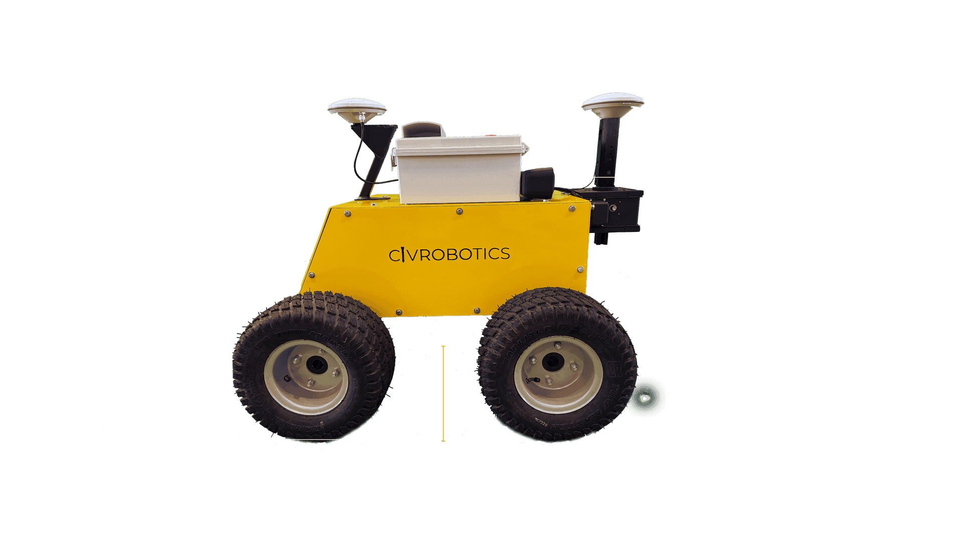
Harnessing dual-RTK, IMU, and a robotic arm, CivDot+ maximizes the GNSS receiver's potential, achieving an impressive 3/100' (8 mm) accuracy.
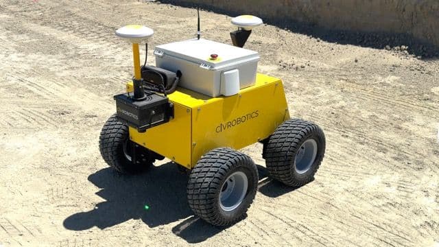
The CivDot+ is a rugged 4WD rover with 10" ground clearance that can handle challenging terrains and harsh climates.
Transform how coordinates are selected, captured, and managed, streamlining your construction site's layout process.
Working with Market Leaders
CivDot+ connects with top brand base stations like Trimble, Topcon, Leica, or NTRIP network for RTK corrections.

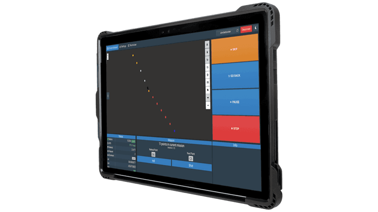
Easy Operation with CivPlan
Robust technology at your fingertips with CivPlan - a preinstalled software that makes data prep and filed operation management easy for everyone.
Enable Safe operations from up to 100' away.
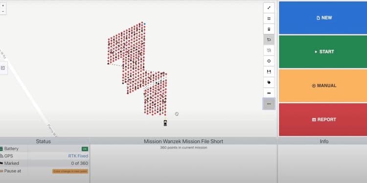
Mission Planning
Upload a csv file with a list of coordinates, select your first point and direction for route optimization, and send CivDot+ on its marking mission.
Field Operation
CivDot+ laser points at the exact position of the coordinate. Follow behind to mark with your choice of physical marker - flags, nails and whiskers, paint or stakes.
The inbuilt speaker directs the operator with a point description, making markings as seamless as possible.
Real-time Reporting
Generate detailed reports of marked coordinates with respective time stamps, tolerance level, and ground elevation. Make informed decisions without waiting on separate data submissions or calculations.
Discover the power of CivRobotics

Connect with us today to learn more. →
© 2025 Civ Robotics inc. All Rights Reserved.